What Drone Operators Need to Know About Orthomosaics and Point Clouds
Why two outputs matter more than one
When you fly a mapping mission, the raw imagery you collect is just the starting point. What clients actually need are finished products: accurate maps they can measure on, and 3D data they can model from. Two of the most common deliverables from drone photogrammetry are orthomosaics and point clouds. Understanding what they are, how they are generated, and where each one fits helps you plan better flights and set the right expectations.
What an orthomosaic is
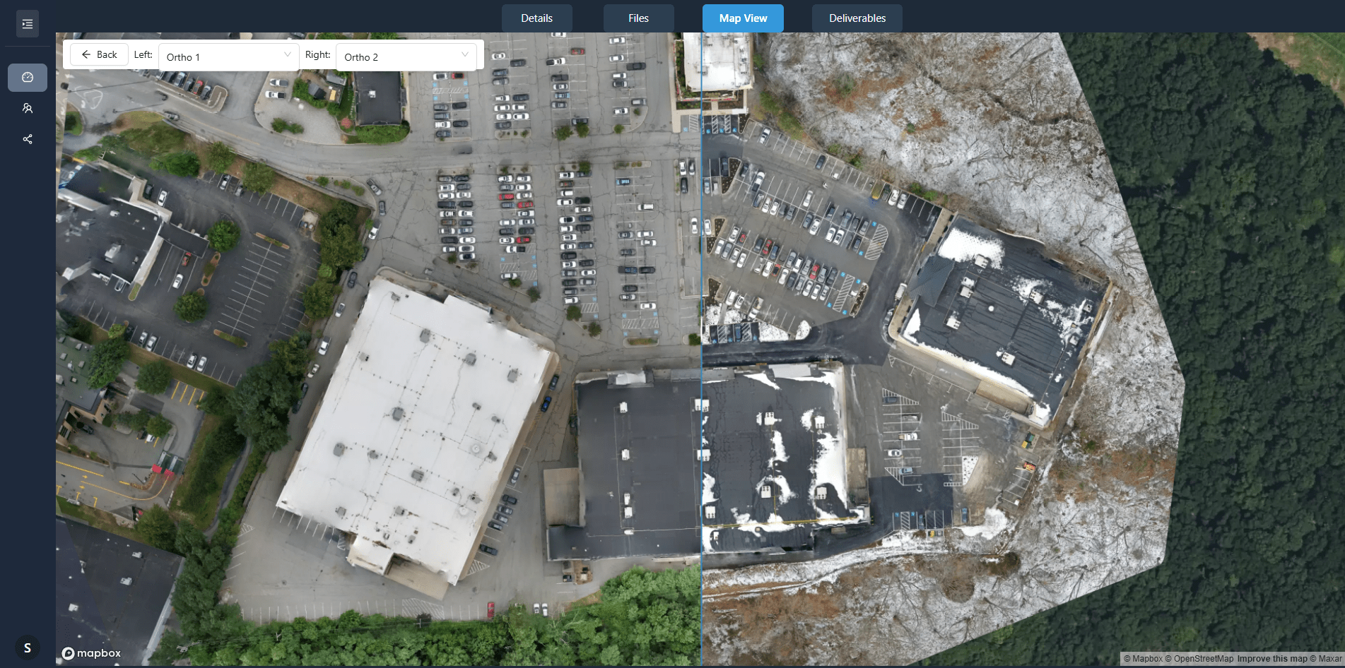
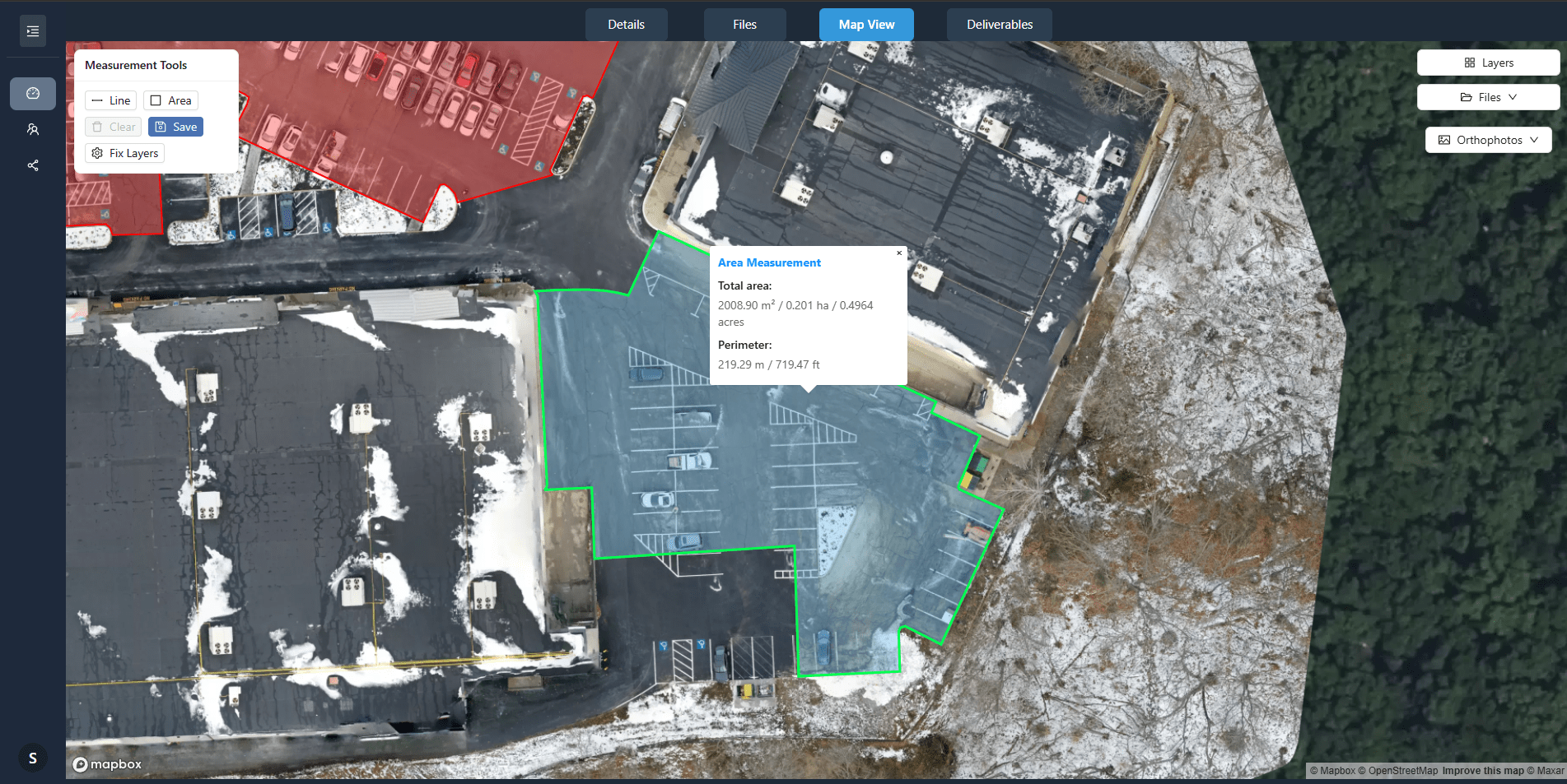
An orthomosaic is a composite image made from many overlapping aerial photos. Each individual photo is corrected for camera lens distortion, perspective, and terrain relief so that it appears as if it were taken from directly above every point on the ground. The result is a single, seamless, georeferenced image where distances and angles are true to scale. You can measure lengths, areas, and perimeters directly on it with confidence.
The process that creates this is called orthomosaic processing. It relies on photogrammetry software to find common points between overlapping images, stitch them together, and then apply a digital surface model to remove topographic distortion. The final product is a large, high-resolution image file that can be opened in GIS software, web viewers, or printed for field use.
What a point cloud is
A point cloud is a collection of 3D coordinates that represent the surface of objects and the ground. Each point has X, Y, and Z values, and often additional attributes like colour or intensity. For drone mapping, point clouds are typically generated from one of two sources: photogrammetry using overlapping imagery, or LiDAR sensors. In photogrammetry, the software calculates 3D positions for thousands or millions of points by triangulating matching features across multiple images. The denser the point cloud, the finer the detail it captures.
Point clouds are not visual images in the usual sense. They are data sets that can be viewed in 3D viewers, used to create digital elevation models, or exported for CAD and BIM workflows. They excel at capturing complex shapes like stockpiles, building facades, or terrain with steep changes.
How they relate to each other
Orthomosaics and point clouds come from the same source: a set of overlapping aerial images. During processing, the software first aligns the images and builds a sparse point cloud of tie points. From that it refines camera positions and generates a dense point cloud. The orthomosaic is then created using the point cloud as a reference to correct each image pixel for elevation. This means the quality of the orthomosaic depends on the quality of the underlying point cloud, and vice versa.
When you deliver shareable orthomosaics and point clouds, you give clients two complementary views of the same data. The orthomosaic gives them a familiar, map-like image they can annotate and share. The point cloud gives them the third dimension they need for volume calculations, cross sections, or as-built verification. Together they cover both visual communication and quantitative analysis.
Key processing steps that affect quality
Ground sampling distance (GSD)
GSD is the distance between pixel centres on the ground. A lower GSD means finer detail. It is determined by flight altitude, camera sensor size, and lens focal length. For orthomosaic processing, consistent GSD across the whole mission is important. If your altitude varies or your camera angle changes, the resulting images will have different resolutions that are harder to align.
Overlap settings
Photogrammetry software needs enough overlap between adjacent images to find matching points reliably. For typical mapping, front overlap of 75-80% and side overlap of 60-70% are common. More overlap gives the software more tie points, which improves point cloud density and orthomosaic accuracy. Less overlap saves flight time but risks gaps or weak alignment in areas with low texture like grass or asphalt.
Georeferencing and ground control
An orthomosaic is only as accurate as its georeferencing. If you fly without ground control points, the absolute accuracy depends on your drone's GPS and the software's internal alignment. For survey-grade work, placing visible targets at known coordinates and including them in the processing gives you a tightly georeferenced output. For many inspection or visualisation tasks, relative accuracy is enough and ground control may be skipped.
What this means for your workflow
Understanding these outputs changes how you plan a mission. If the final deliverable is only an orthomosaic, you can fly with slightly less overlap and accept a sparser point cloud. If the client needs both a high-resolution orthomosaic and a dense point cloud for volume calculations, you need to fly lower, with higher overlap, and ensure good lighting conditions so texture is visible in every image.
The processing step is where the two outputs diverge. Producing shareable orthomosaics and point clouds from the same dataset requires software that can handle both pipelines without re-processing the raw imagery from scratch. Some platforms let you adjust point cloud density after alignment, or export the orthomosaic at different resolutions. This flexibility saves time when a client later asks for a higher detail point cloud or a lighter orthomosaic for web viewing.
Common pitfalls and how to avoid them
- Motion blur from flying too fast or using too slow a shutter speed blurs the images and reduces tie point quality. Keep shutter speed high relative to ground speed.
- Changing light conditions during a long mission can cause visible seams in the orthomosaic. Fly in consistent lighting or use software that adjusts exposure across images.
- Low-texture surfaces like water, fresh asphalt, or snow make it hard for the software to find matching points. Plan to avoid these areas or include artificial markers where possible.
- Ignoring coordinate system differences between your drone's GPS and the client's reference system leads to shifted outputs. Confirm the required coordinate system before processing.
Putting it into practice
For a typical construction site survey, you might fly a grid pattern at a height that gives you the GSD the client specified. After the flight, you import the images into processing software. The software first aligns all images and builds a point cloud. Then you review the point cloud for density and coverage. If there are gaps, you can add more images or adjust processing parameters. Once the point cloud is satisfactory, you generate the orthomosaic. The whole workflow from flight to deliverable can take from a few hours to a full day, depending on the area and the level of detail required.
Delivering both outputs gives your client immediate value. They can open the orthomosaic in a standard viewer, take measurements, and share it with colleagues. The point cloud sits alongside, ready for the engineer or surveyor who needs to run volume reports or create a digital terrain model. Having both from a single flight saves time and reduces the need for a second visit.
Choosing the right approach
Not every project needs a dense point cloud. For a simple roof inspection, a well-made orthomosaic with good resolution is often enough. For a stockpile volume calculation, the point cloud is essential and the orthomosaic is secondary. Knowing which output drives the project helps you decide where to invest your flight time and processing effort.
Similarly, the software you use matters. Some platforms are built for speed and produce an orthomosaic quickly with a basic point cloud. Others are designed for photogrammetric precision and give you full control over point cloud generation and filtering. Matching the tool to the job prevents over-processing on simple tasks and under-delivering on complex ones.
As drone mapping becomes more common, clients are learning to ask for both outputs. Being able to explain the difference between an orthomosaic and a point cloud, and to deliver them together, sets you apart from operators who only hand over a single image file. It shows you understand what the data can do and how it fits into the larger project workflow.
Ends · SURVEYSKY